KLD - Personal details
|
|||||||||
| Born | 1942 in Göfis, Vorarlberg, Austria | ||||||||
| Citizen | Swiss (since 1979; Fällanden, ZH). Living in Zürich since 1963, the year when the Lake of Zurich was frozen for several weeks (even trucks could cross the lake). | ||||||||
| Education | School of Technology, Bregenz, Austria (matura) | ||||||||
| Profession | Starting as mechanical engineer at the drafting board Klaus changed to informatics and from there to the field of technical writing. Since 1960 I write «with limited capitalisation» (this is only an issue in the German language) — gemässigte kleinschreibung. | ||||||||
| Family | Wife Inge was a kindergarten teacher until Michael was born 1975. Mirjam was born 1977 and Mathias 1987. | ||||||||
| Our name is famous ... | We may be the only family with an own view point and an own mountain peak in the Bernese alps (see reference According to language experts the geographical name Daube most likely comes from tube-/dube which in turn stems from the gallic ~dubo (= black or dark). And there is this beef stew from the Provence: depending on the cook book its called «daube provencale», «daube bourguignon» or «boeuf en daube». In our family we proudly call it «Bourguignon à la Daube». |
Reference
Unfortuantely this book is wrong:
Charles Knapp, Maurice Borel
et. al, Geographisches Lexikon der Schweiz, Neuenburg 1902, Verlag
der Gebrüder Attinger:
«Daube (kanton Bern, bailiwick of Interlaken) 6772 ft. Well known peak in the chain of the Faulhorn. 5km southeast of Interlaken east above Gsteigwiler. North over the small hotel on the Schinige Platte (shiny plate), from where the peak can be climbed within ½ hour. Certainly one of the most beautiful views in the Bernise Highland to the Bödeli, the lakes and the surrounding mountain scene.»
Original: Daube (Kt. Bern, Amtsbezirk Interlaken) 2064m,. Wohlbekannter Gipfel in der Kette des Faulhorns, 5km so Interlaken und östlich über Gsteigwiler. N über dem Gasthaus auf der Schinigen Platte, von wo aus er in ½h bestiegen werden kann. Bestimmt einer der schönsten Ausichten im Berner Oberland auf das Bödeli, die Seen un die umgebende Gebirgswelt.
Detailed research makes clear, that this Daube is a View Point, but there is another Daube in Switherland, which definetely is a mountain peak (see the last reference).
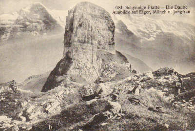
| A postcard from 1920 looks to the south:«View from the Daube to Eiger, Mönch and Jungfrau» Due to the promiment item in the middle of the view I thought this would be the Daube, but ... This thumb shaped actually is the Gummihorn. The Daube is the place where the person lies in the grass. |
 |
| In 2007 I hiked to this place. The new signpost definetly clears the situation. | 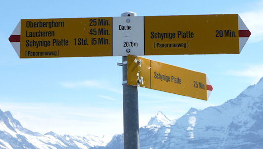 |
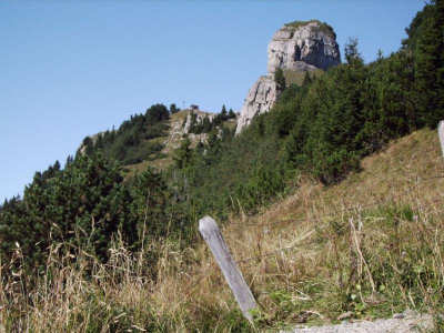
| View from the hiking trail starting at the Schynige
Platte to the north. The place Daube is in the background on the 'hill'. |
 |
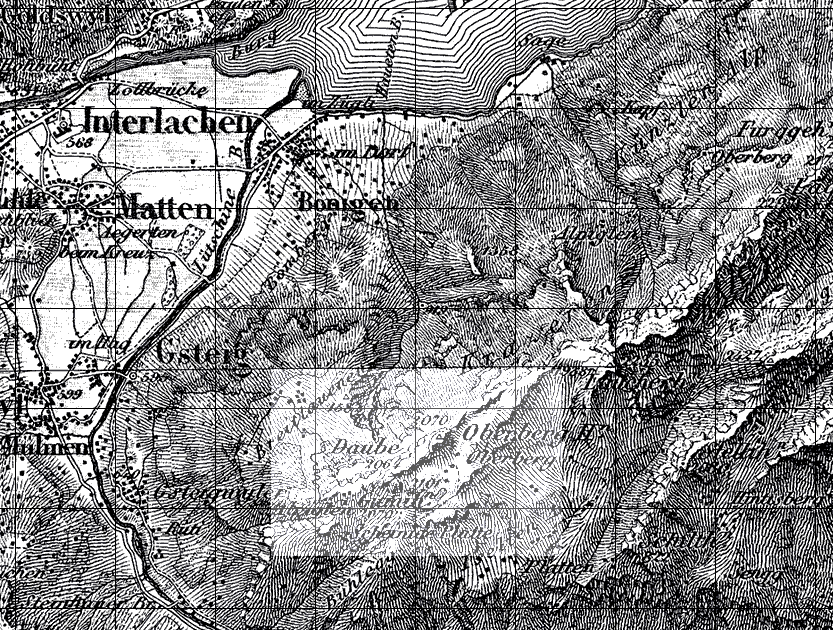
| Part of the Dufour map (issued around 1900) showing the area with the Daube in the Bernese Alps. On this map it is not clear wether Daube is a place or a peak. |
 |
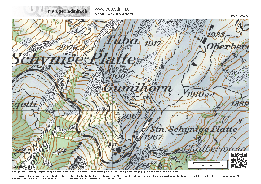
| Screenshot as of 2012-07-12 from the interactive map of SwissTopo.
The scale is 1:5000. The dotted triange betwenn the text Schynige and Platte is the place with an elevation of 2078.3 m The top ot the Gumihorn is the small x to the left of the 2100 mark. See the map extract as PDF. |
 |
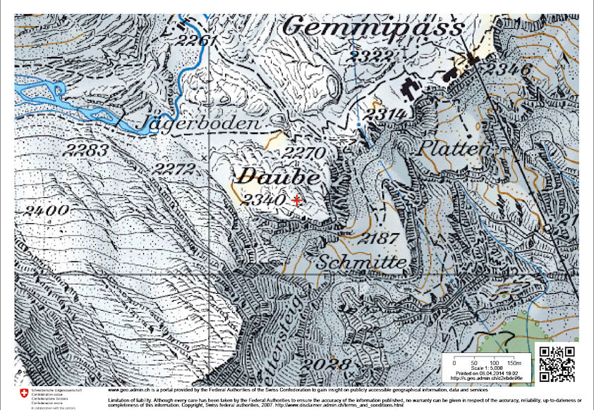
| And there is however a peak named Daube close to the Gemmi pass (between the cantons Berne and Valais). The Daubensee (lake Daube) is also there and another peak: Daubenhorn. See the map extract as PDF. |
 |